


3,9 km | 5,3 km-effort
![Tocht Te voet Staré Město - [Ž] Moravskotřebovský okruh - Photo](https://media.geolcdn.com/t/1900/400/a0c081a5-939f-4ea4-9866-a1839ea3719e.jpeg&format=pjpeg&maxdim=2)

Tous les sentiers balisés d’Europe GUIDE+


Gratisgps-wandelapplicatie
 SityTrail
IGN / Geografische instituten
SityTrail World
De wereld gaat voor u open
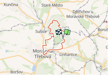
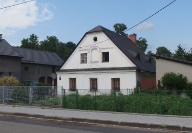
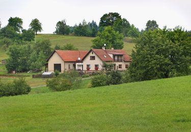
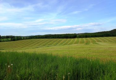
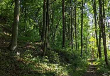
Tocht Te voet van 9,9 km beschikbaar op Noordoost, Pardubický kraj, Staré Město. Deze tocht wordt voorgesteld door SityTrail - itinéraires balisés pédestres.
Tocht aangemaakt door cz:KČT.
![Tocht Te voet Staré Město - [Ž] Moravskotřebovský okruh - Photo 1](https://media.geolcdn.com/t/2048/auto/29ba1ae0-b6f3-43e0-a118-5681a83c473f.jpeg&format=jpg&maxdim=0 "Tocht Te voet Staré Město - [Ž] Moravskotřebovský okruh - Photo 1")
![Tocht Te voet Staré Město - [Ž] Moravskotřebovský okruh - Photo 2](https://media.geolcdn.com/t/2048/auto/6b165af8-2df6-47f1-82e6-aea39a161086.jpeg&format=jpg&maxdim=0 "Tocht Te voet Staré Město - [Ž] Moravskotřebovský okruh - Photo 2")
![Tocht Te voet Staré Město - [Ž] Moravskotřebovský okruh - Photo 3](https://media.geolcdn.com/t/2048/auto/58a6e257-c4e7-4067-aa1d-d9b9c383fcdd.jpeg&format=jpg&maxdim=0 "Tocht Te voet Staré Město - [Ž] Moravskotřebovský okruh - Photo 3")
![Tocht Te voet Staré Město - [Ž] Moravskotřebovský okruh - Photo 4](https://media.geolcdn.com/t/2048/auto/94c9c114-2301-4859-b14d-171a227e225e.jpeg&format=jpg&maxdim=0 "Tocht Te voet Staré Město - [Ž] Moravskotřebovský okruh - Photo 4")
![Tocht Te voet Staré Město - [Ž] Moravskotřebovský okruh - Photo 5](https://media.geolcdn.com/t/2048/auto/1454c713-bbe9-4365-bad3-ac512706f6ad.jpeg&format=jpg&maxdim=0 "Tocht Te voet Staré Město - [Ž] Moravskotřebovský okruh - Photo 5")
![Tocht Te voet Staré Město - [Ž] Moravskotřebovský okruh - Photo 6](https://media.geolcdn.com/t/2048/auto/f93c77d3-b64b-4fb1-b7b6-31d38f734c16.jpeg&format=jpg&maxdim=0 "Tocht Te voet Staré Město - [Ž] Moravskotřebovský okruh - Photo 6")
![Tocht Te voet Staré Město - [Ž] Moravskotřebovský okruh - Photo 7](https://media.geolcdn.com/t/2048/auto/b25d51a9-2dfe-4a6f-9790-bb105e9aac20.jpeg&format=jpg&maxdim=0 "Tocht Te voet Staré Město - [Ž] Moravskotřebovský okruh - Photo 7")
![Tocht Te voet Staré Město - [Ž] Moravskotřebovský okruh - Photo 8](https://media.geolcdn.com/t/2048/auto/caf03fac-734d-4a5e-a861-13ffa04ff8b3.jpeg&format=jpg&maxdim=0 "Tocht Te voet Staré Město - [Ž] Moravskotřebovský okruh - Photo 8")
![Tocht Te voet Staré Město - [Ž] Moravskotřebovský okruh - Photo 9](https://media.geolcdn.com/t/2048/auto/08abdb18-ba2c-46e8-aacd-bbf368c00e27.jpeg&format=jpg&maxdim=0 "Tocht Te voet Staré Město - [Ž] Moravskotřebovský okruh - Photo 9")
![Tocht Te voet Staré Město - [Ž] Moravskotřebovský okruh - Photo 10](https://media.geolcdn.com/t/2048/auto/a0c081a5-939f-4ea4-9866-a1839ea3719e.jpeg&format=jpg&maxdim=0 "Tocht Te voet Staré Město - [Ž] Moravskotřebovský okruh - Photo 10")
Te voet
![Tocht Te voet Konice - [Z] Runářov - Konice - Photo](https://media.geolcdn.com/t/375/260/90af7c62-097b-4fe0-b74f-f80499e5b5f8.jpeg&format=jpg&maxdim=2)
Te voet
Te voet
Te voet
Te voet
Te voet
![Tocht Te voet Tatenice - [M] Cukrová bouda - Tatenice - Photo](https://media.geolcdn.com/t/375/260/d7936ed9-d5a8-4f9e-8f62-c7c3895a88ed.jpeg&format=jpg&maxdim=2)
Te voet
Te voet
Te voet